Worth remembering
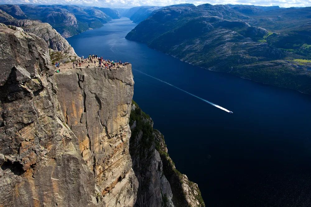
- The Preikestolen cliff rises 604 metres above the Lysefjord in Ryfylke, straight down to the water.[3]
- Glaciers in the last Ice Age, around 10,000 years ago, carved the deep valleys that became the Lysefjord.[4]
- A fissure runs across the flat top of the rock, right where you step onto the plateau.
- The Lysefjord is 41 miles (66 km) from Stavanger by road, a drive of around an hour and a half.[5]
- The electric fjord cruise runs 3.5 hours and shows the cliff from the water.[6]
- Top choice Electric fjord cruise from US$75 Duration3.5 hours[6]Rating4.62 from 9,730 reviews[6]GuideAudio guide included[6]AccessWheelchair accessible[6] Check availability
- Low-emission cruise from US$76 Duration2.5 hours[7]Rating4.81 from 2,256 reviews[7]GuideAudio guide included[7]AccessWheelchair accessible[7] See this tour
- Preikestolen guided hike from US$168 Duration6 hours[8]Rating4.80 from 439 reviews[8]GuideLive tour guide[8]AccessGuided walk to the plateau[8] See this tour
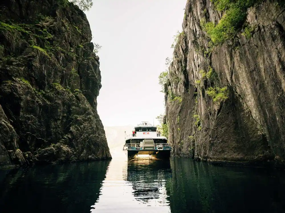
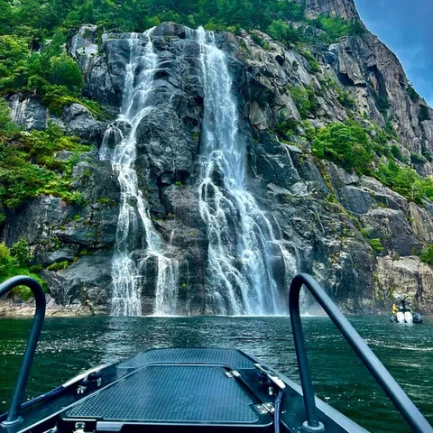
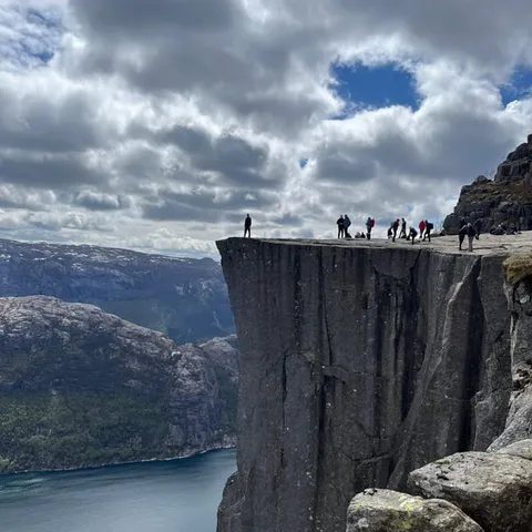
The Lysefjord is approx. 40 kilometres in length It is up to 422 metres deep, but shallows to only 13 metres near Oanes and Forsand.
Is the Preikestolen cliff worth the trip?
Plan and book
How Preikestolen Was Carved by Ice
The Lysefjord is a valley that the sea moved into after the ice left it. Glaciers during the last Ice Age, around 10,000 years ago, carved deep valleys into this landscape, and the Lysefjord is one of them.[4] Preikestolen sits at the side of that valley, a corner of the wall the ice did not shatter, holding its flat top while the slope behind it fell away.
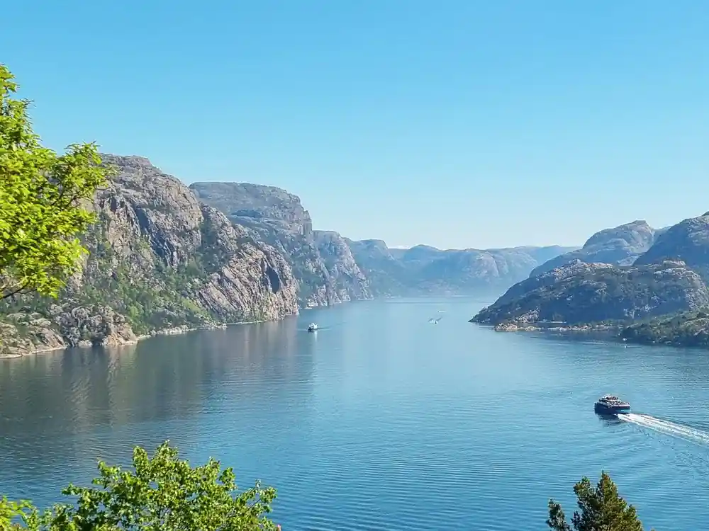
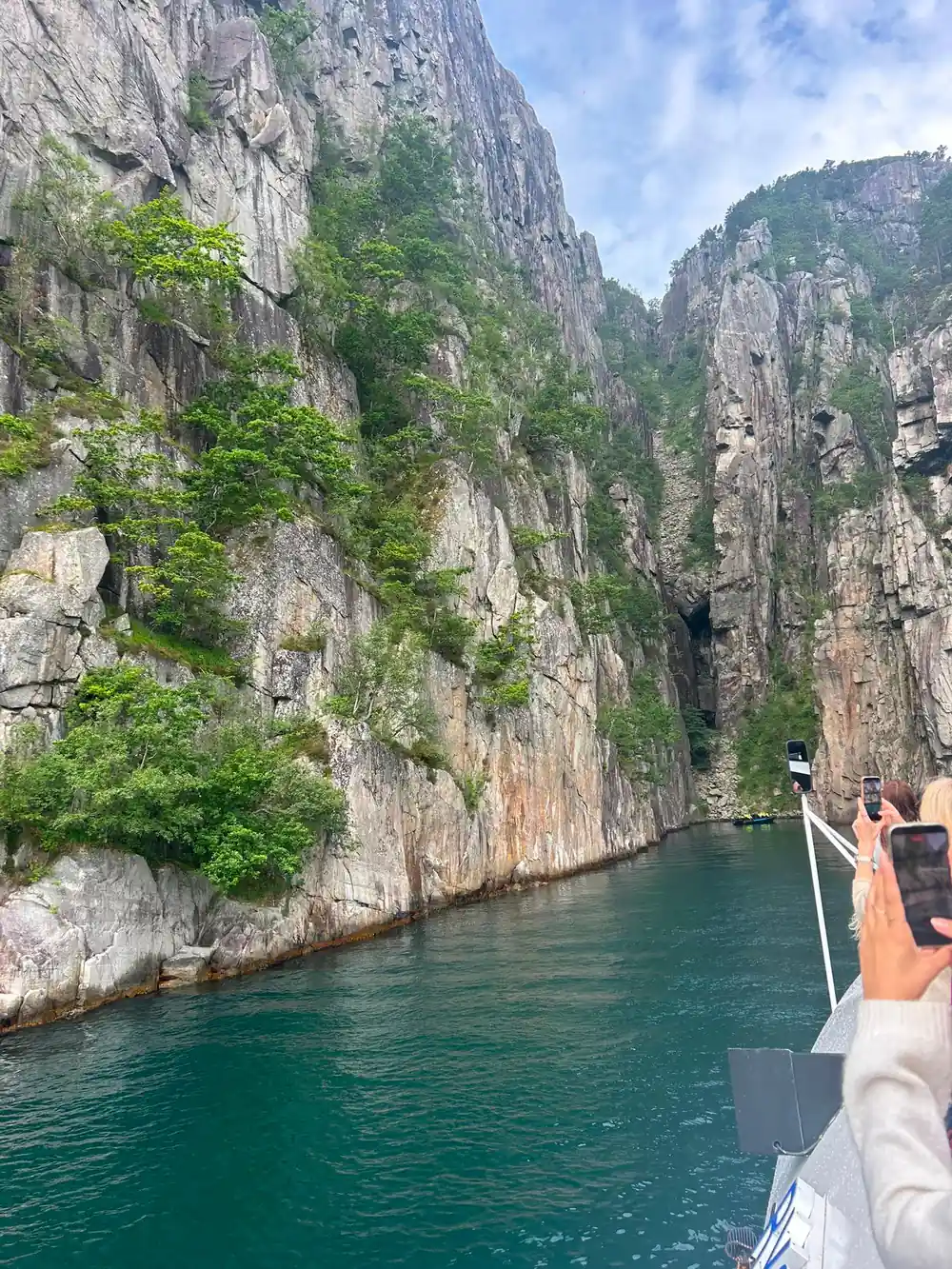
From the water, the proportions are the story. The Lysefjord is approximately 40 kilometres long and up to 422 metres deep, and it shallows to only 13 metres near Oanes and Forsand.[11] That mix of length, depth and a narrow channel is what makes the walls on either side read as cliffs rather than hillsides. A boat that looks big at the pier becomes small once it is under the rock.
The same ice left other shapes along the fjord. At the inner end, Kjeragbolten is a boulder wedged 1,000 meters above Lysefjord, reached by a strenuous 12 km trail, and the difference between a loose block stuck in a crevice and a shelf of solid granite shows how differently two valley walls can behave.[12]
The Granite Behind the Preikestolen Cliff
The Preikestolen cliff is a granite shelf, and the granite is a large part of why it has lasted. The rock here is hard and coarsely grained, and it breaks along straight joints rather than crumbling, which is how a platform can sit above open air with a slope of loose stone below it. The top is broad and almost level, wide enough to walk about on, and the drop only becomes real when you get near it.
The figure most people want first is the height. Preikestolen rises 604 metres above the Lysefjord in Ryfylke, which is the fall from the ledge to the water underneath.[3] That measurement is the Preikestolen cliff above the fjord, not an altitude above sea level. From the deck of a cruise boat the plateau is a thin dark line, and the rock beneath it is a long, pale wall.
The approach changes what you see. From the water, the top of the cliff disappears as the boat gets close and you mostly look at the wall. On foot, the plateau stays hidden behind the ridge until the last rise, and then it arrives all at once with the fjord far below. If you have the time for both, do both, because the rock reads completely differently from above and below.
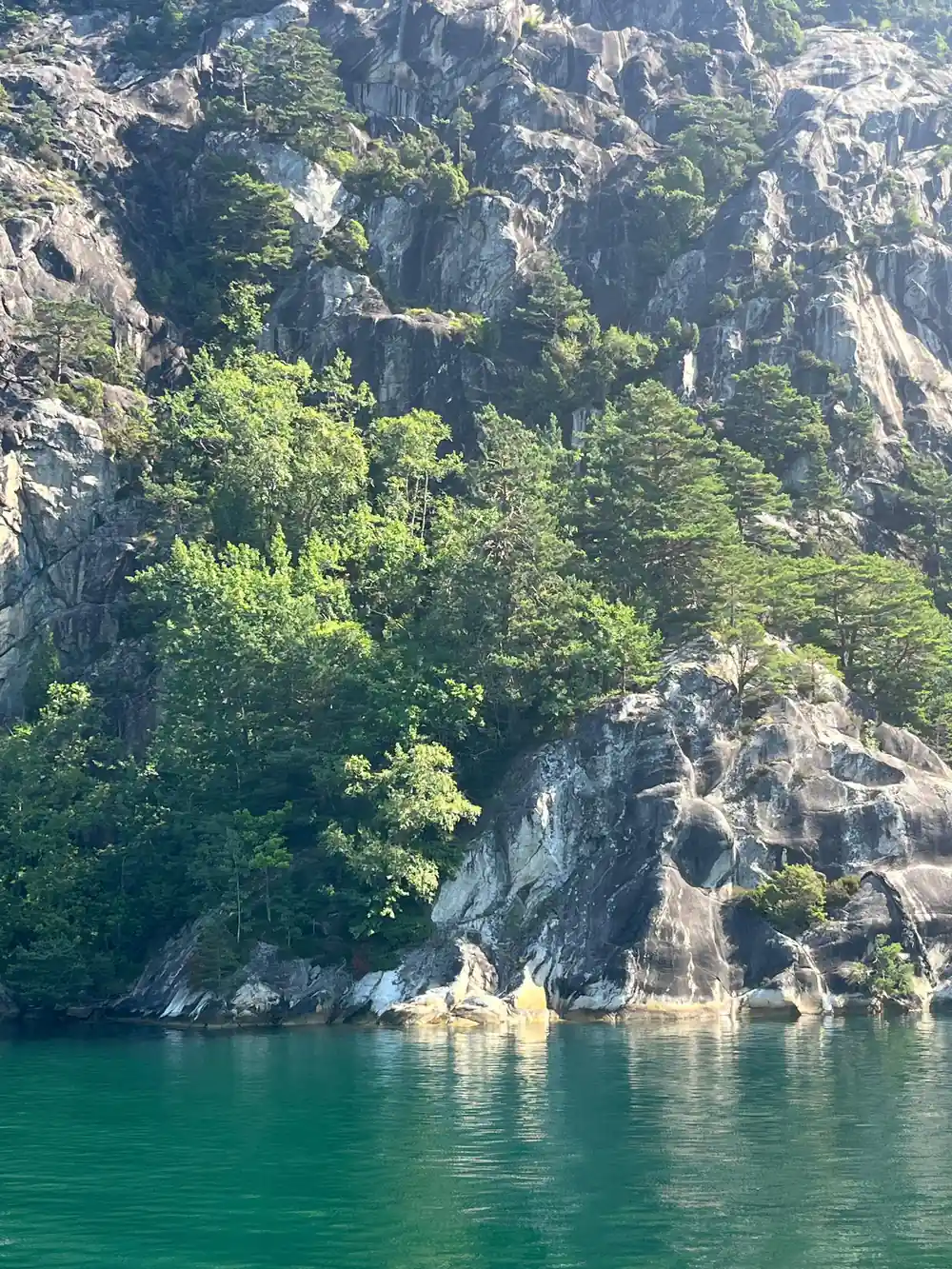
The flat plateau above the Lysefjord gives the Preikestolen cliff its name
The Crack in the Pulpit Rock
Walk out onto the plateau and you meet the crack almost at once. It runs across the top of the rock as a straight fissure in the granite, and on a windy day it is the detail people remember afterwards. It looks alarming: so clean, and sitting in the middle of what otherwise seems to be one solid shelf.
Cracks like this are what granite does. The rock is jointed, and joints open as the weight above them is removed and as frost and meltwater work away at the line of weakness. The fissure on Preikestolen is one of those joints, opened wider over a very long time. Crossing it feels much stranger than it is.
The crack is part of the walk out to the edge, and plenty of people step over it without stopping. It rewards a moment of attention instead, because the fissure is the clearest window you get into how the plateau is put together, and it explains why the top of the rock is as flat as it is.
How to Pronounce Preikestolen
The first question most visitors have is how to pronounce Preikestolen, and the answer is friendlier than the spelling suggests. Break the word into three: PRY-ke-stoh-len. The first syllable rhymes with sky, the middle one is short, and the last is light, with the stress at the front of the word.
English speakers tend to hit every syllable equally, which sounds odd to Norwegian ears but is understood without any difficulty. If the vowels will not behave, the Pulpit Rock works everywhere, and the English name sits alongside the Norwegian on signs, tickets and timetables around Stavanger harbour.
Norwegian vowels are the fiddly part: the ei is a diphthong that slides from an a sound towards an i, and the o is round and short. None of that matters much in practice. Say it with confidence, or point at the boat, and you will end up in the right place either way.
604 m
Preikestolen rises 604 metres above the Lysefjord in Ryfylke. From the water, it reads as a sheer wall of granite with a flat shelf on top.[3]
What the Name Preikestolen Means
The name is a compound, and its meaning is domestic rather than dramatic. Preike is the dialect word for preaching and stol means chair, so the two halves together give the pulpit, the stand a preacher speaks from in church. It is a comparison rather than a description, made by people who looked up at the rock from the fjord.
Look at the shape and the comparison holds. There is a flat top, a vertical face below it, and a clear gap between the shelf and the mountainside behind it, which is roughly what a pulpit looks like from the back of a church. Norwegians say the name without picturing the furniture, the way English speakers say Pulpit Rock without thinking about sermons.
Names elsewhere on the fjord are just as practical. Lysebotn, Flørli, Kjerag and Songesand all describe a place rather than commemorate a person, which is a naming habit that tells you what a landscape is for. Here, the name says the rock looks like something a preacher stands behind, and the view from the water makes the point for itself.
Preikestolen on Film and in the Public Eye
The plateau is a natural stage. It has a flat floor, a clean edge and a backdrop of water, mountain and sky, and that combination has been drawing photographers and film crews for a long time. The cliff has turned up on cinema screens and in advertising, usually as somewhere wild, empty and almost impossible to reach.
What a camera cannot carry across is the weight of the place. Wide shots flatten the drop and make the ledge look like a diving board over a pond, and the cold coming up off the fjord does not survive the edit at all. Standing there is a different experience from watching it, which is roughly why people book the boat or the hike in the first place.
It is also why the cliff needs no introduction. The silhouette is familiar before you arrive, and the moment of recognition on the water is oddly powerful. That is a good reason to give the rock a long look from the deck rather than a quick photograph on the way past.
Planning Your Visit to the Ledge
Two approaches work well from Stavanger. The Lysefjord is 41 miles (66 km) from Stavanger and the drive takes around an hour and a half.[5] Cruise ships berth at Skagenkaien, Strandkaien or Skansekaien in Vågen, the city-centre inner harbour, so passengers step off in the middle of Stavanger rather than at an out-of-town terminal.[13] Without a car, the Sørlandsbanen train from Oslo to Stavanger takes around seven to eight hours, and a year-round local ferry sails the Lysefjord with calls at Lysebotn.[14][15]
If you want to stand on the ledge, the hike is less than 10km (6.2 miles) long with an elevation gain of just over 600m, and it takes about 3 to 4 hours to complete.[9] The trail stays open year-round, including through the winter off-season, though winter is a different proposition from summer and needs a different kit list.[16] If you would rather not climb, the silent hybrid-electric cruise from Stavanger runs 3.5 hours and shows the cliff from below, and a two-hour RIB safari covers the same water at speed.[17][18]
There are quieter ways to see the water too. Guided kayak tours on the Lysefjord run in private groups of up to 12 people, and if you want to stay overnight, the architecturally unique cabins at The Bolder are designed to minimise environmental impact.[19][20] Further along the fjord, Lysevegen has 27 hairpin bends and the Flørli stairway has 4444 steps, both a solid day out from the plateau but part of the same landscape.[21][22]
Heights around the Lysefjord
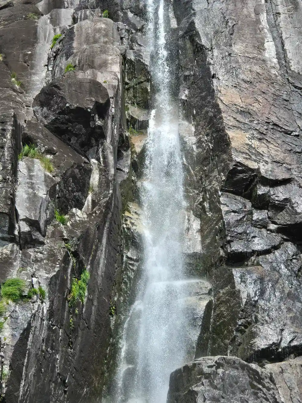
Preikestolen rises 604 metres above the Lysefjord[3]. Kjeragbolten is a boulder wedged 1,000 meters above Lysefjord[12]. Hengjanefossen waterfall is reported at a height of around 400 meters in a Komoot user tip[23].
From prices for seeing the cliff
From prices per person for these GetYourGuide listings[6][7][8][24]
When to go to Preikestolen
Plan your Preikestolen day
On the way there
The Lysefjord is 41 miles (66 km) from Stavanger and the drive takes around an hour and a half.[5]
From the water
A silent, hybrid-electric cruise from Stavanger lasts 3.5 hours and shows Preikestolen from the water.[17]
On foot
The hike is less than 10km (6.2 miles) long with just over 600m of ascent, and takes about 3 to 4 hours.[9]
Any season
The trail to Preikestolen is open year-round, including during the winter off-season.[16]
Book ahead
Reserve now and pay later on the electric cruise, with free cancellation up to 24 hours in advance.[6]
See the Preikestolen cliff from the water on an electric cruise
from US$76Reserve now & pay later